林业土壤活土层available layer offorestry soil
使林木根系,特别是侧根、细根能正常生长发育的土层。林木根系分布的一般模型,是最大量的侧根和细根位于土壤剖面的上层。此层包括O层和A层,有时,还包括E层和B1层。影响根系正常生长发育的土壤因子,是水、气、热、肥(P、K、Ca更重要些)和机械阻力。其中,以土壤物理性质的障碍最为常见。如坚硬基岩、黏盘、钙积层、网纹层等分布浅,地下水位高,土壤容重大(黏质土>1.45,轻质土>1.7)等。这些都可作为划分活土层厚度的指标。根据需要和可能,采用客土、深翻碎土、开沟排水、施肥等措施,都可改善和增加活土层厚度,促进林木生长。
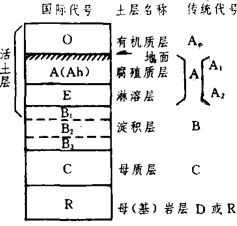
土壤剖面构造模式图