主要责任者: 徐杰舜;万建中,周耀明
责任方式: 主编;著
出版者: 学林出版社
出版地: 上海
字数: 1870 千字
页码: 1-468
开本: 32
中图分类号: K892.311
装帧: 简
分辑名:第五卷 清代后期·民国汉族风俗
语种:中
定价:128.00(全五卷)
出版时间:2004-12
丛书多卷书否:是
书目简介:本册工具书共收录190条词条。
被引频次:240
主要责任者: 徐杰舜;万建中,周耀明,陈顺宣
责任方式: 主编;著
出版者: 学林出版社
出版地: 上海
字数: 1870 千字
页码: 1-538
开本: 32
中图分类号: K892.311
装帧: 简
分辑名:第三卷 隋唐·五代宋元汉族风俗
语种:中
定价:128.00(全五卷)
出版时间:2004-12
丛书多卷书否:是
书目简介:本册工具书共收录372条词条。
被引频次:120
主要责任者: 徐杰舜;周耀明
责任方式: 主编;著
出版者: 学林出版社
出版地: 上海
字数: 1870 千字
页码: 1-443
开本: 32
中图分类号: K982.311
装帧: 简
分辑名:第四卷 明代·清代前期汉族风俗
语种:中
定价:128.00(全五卷)
出版时间:2004-12
丛书多卷书否:是
书目简介:本册工具书共收录246条词条。
被引频次:30
主要责任者: 徐杰舜;周耀明,万建中,陈华文
责任方式: 主编;著
出版者: 学林出版社
出版地: 上海
字数: 1870 千字
页码: 1-441
开本: 32
中图分类号: K892.311
装帧: 简
分辑名:第二卷 秦汉·魏晋南北朝汉族风俗
语种:中
定价:128.00(全五卷)
出版时间:2004-12
丛书多卷书否:是
书目简介:本册工具书共收录286条词条。
被引频次:120
主要责任者: 徐杰舜;徐杰舜
责任方式: 主编;著
出版者: 学林出版社
出版地: 上海
字数: 1870 千字
页码: 1-380
开本: 32
中图分类号: K892.311
装帧: 简
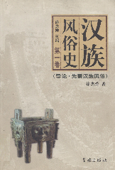
分辑名:第一卷 导论·先秦汉族风俗
语种:中
定价:128.00(全五卷)
出版时间:2004-12
丛书多卷书否:是
书目简介:本册工具书共收录212条词条。
被引频次:99