黑颈鹤heijingheGrus ni-gricollis
脊椎动物,鸟纲,鹤科。大型涉禽类的一种,是世界上鹤类中唯一的高山种。体长约1.4米,体重可达7.5公斤以上。头、颈、飞羽和尾羽均为黑色,体羽灰白色。体型颇为健美。主要栖息在距离水面较近、并生长有较高水草的沼泽地。主食鱼、蛙、螺、虾等。多在青海和四川西部海拔3500~5000米的高山草甸和高原湖泊边,以及湖中岛上沼泽地繁殖后代。集群迁徙时,经青藏高原而至四川西南部、贵州西部、云南、西藏南部及更南地方越冬。特别是云南迪庆州的纳帕海和贵州威宁的草海等高原淡水湖泊,水草繁茂,为良好越冬场所。夜宿或休息时,多是就地而卧,或将头藏于翅下。藏族称黑颈鹤为“神鸟”,异常爱护,从不猎捕杀害,由于珍稀,现已被列为国家一级保护动物。
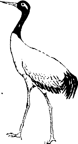
图349 黑颈鹤
黑颈鹤
鹤形目鹤科,涉禽。体重2.5千克左右,体长0.7—0.9米。颈、腿长。眼先、头顶前方裸露皮肤暗红色;头和前颈及飞羽黑色;尾羽黑褐色;其余体羽灰白色。分布在阿尔泰山、天山、阿尔金山的高山湖泊。杂食性,以鞘翅目昆虫为主。属国家一级保护动物。
黑颈鹤
别名黑头鹤。鸟纲鹤形目鹤科鹤属。栖于高海拔的开阔草原、沼泽或湖泊岸边,成对或3~5只为小群。以水生动植物、蛙类、昆虫等为食。分布于玛曲、碌曲和肃北等县。中国特产鸟类,是动物园内最名贵的展览涉禽。国家一级保护野生动物。