勇士勋章Decorations for Bravery
为表彰和鼓励在危急关头见义勇为的勇士于1972年设立的勋章。分勇士十字勋章、勇士星章和勇士勋章三个等级。
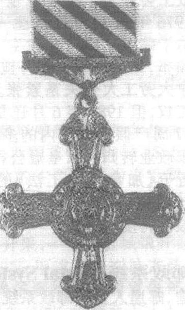
勇士十字勋章 继维多利亚十字勋章和乔治十字勋章后,最高的加拿大荣誉勋章为一级勇士勋章。主体是金质十字,正面中央是由花环围绕的枫叶,底质为红色珐琅,背面有英、法两种文字的“豪勇”字样,绶带为红色。
勇士星章 二级勇士勋章。主体是一个银质四角星,正面中央也是一个由花环围绕的枫叶图案,背面有英、法两种文字的“刚勇”字样,绶带为红色,边缘各有蓝色条纹。
勇士奖章 三级勇士勋章。主体为银质,是正圆形,正面中央也是由花环围绕的枫叶,背面是英、法两种文字的“英勇”字样,绶带为红色,有三条蓝色条纹。
颁发勋章的程序是:总督听取授勋顾问委员会的建议,与警方调查核实后授奖。受奖者可在自己的姓名后加上CV(一级勇士勋章)、SC(二级勇士勋章)或MB(三级勇士勋章)字样,以示所受荣誉。
勇士勋章
- Augsburg,League of
- Augsburg,Peace of
- augury
- August
- Augusta
- Augusta
- Augustan History
- Augustine of Canterbury,St
- Augustine of Hippo,St
- Augustus
- Augustus Ⅰ
- Augustus Ⅱ
- Auius Persius Flaecus
- auk
- Aung San
- Aunra
- Aurangzeb
- Aurelianus,Lucius Domitius
- auricula
- Auric,Georges
- Auriga
- Aurignacian
- Auriol,Vincent
- auroehs
- Aurora