栏杆
又称阑干、槛楯,宋代称“钩栏”。是古代建筑中安置于台、坛、楼、桥、塔、廊等高耸或危险之处的,在空间组织上起规限隔断和保护作用的装置。栏杆初为木制,以木条纵横相交,固定而成。后来在建筑上成为常用的构件。种类繁多,结构多样,多装饰有精美的雕刻。从而使栏杆成为建筑物中的一种重要装饰。除木制外,还有石制及砖制栏杆。按其作用与结构又分为:桪杖栏杆、花栏杆、坐橙栏杆、靠背栏杆、栏板式栏杆、櫼子栏杆、罗汉栏杆等。
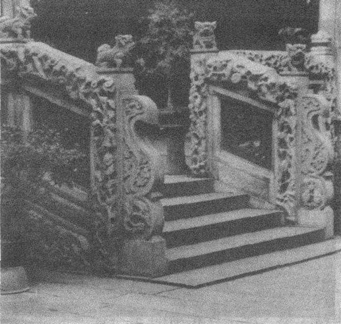
广东陈家祠堂踏蹂栏杆
| 词条 | 栏杆 |
| 类别 | 中文百科知识 |
| 释义 | 栏杆又称阑干、槛楯,宋代称“钩栏”。是古代建筑中安置于台、坛、楼、桥、塔、廊等高耸或危险之处的,在空间组织上起规限隔断和保护作用的装置。栏杆初为木制,以木条纵横相交,固定而成。后来在建筑上成为常用的构件。种类繁多,结构多样,多装饰有精美的雕刻。从而使栏杆成为建筑物中的一种重要装饰。除木制外,还有石制及砖制栏杆。按其作用与结构又分为:桪杖栏杆、花栏杆、坐橙栏杆、靠背栏杆、栏板式栏杆、櫼子栏杆、罗汉栏杆等。
广东陈家祠堂踏蹂栏杆 |
| 随便看 |
开放百科全书收录579518条英语、德语、日语等多语种百科知识,基本涵盖了大多数领域的百科知识,是一部内容自由、开放的电子版国际百科全书。