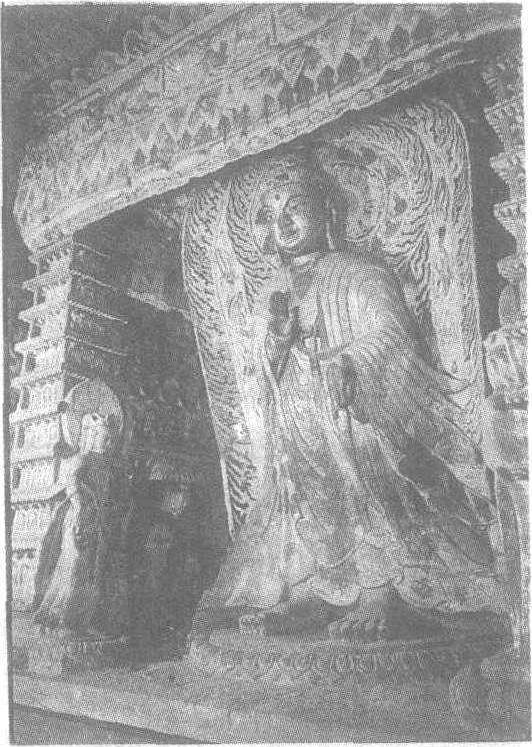
石雕佛龛
北魏。山西省大同市云冈石窟第6窟中心塔柱上层南龛。龛楣作华盖式,下饰垂幛纹。龛内雕一立佛,服装为褒衣博带式。是孝文帝推行汉化政策时出现的款式。衣褶飘洒而流畅,通体呈三角状撒开,十分美丽。佛赤脚站立于覆形莲瓣装饰的圆座之上,发髻为波纹状,面如圆月,双目十分有神。右手作施无畏印,左手作与愿印。背光的纹饰精细繁复。佛两侧有胁侍菩萨二身,戴宝冠,披长巾,着大裙,身材匀称,神态恭敬。二龛柱为九级方塔形,四角置于象背之上。方塔仿木结构,筒瓦、出檐和椽头等一一雕出。每层的每面均刻三身坐佛。第6窟中心塔柱的上层每面均按此龛的模式雕刻,富丽堂皇。
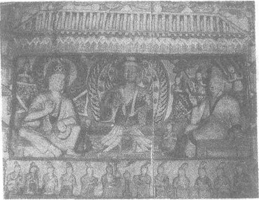
石雕佛龛
北魏。龛高200厘米。山西省大同市云冈石窟第6窟后室南壁中部。佛龛为屋形,屋脊、筒瓦、椽头雕刻精致。两柱雕作五级塔形,仿木构建筑。龛内有释迦牟尼、维摩、文殊三像。释迦牟尼穿通肩袈裟,作施无畏印,正襟危坐于束腰方形座上。左侧的维摩戴尖帽,蓄长须,着深色衣缘的交领衣,一手扶床,一手举尘尾。右侧的文殊头戴宝冠,着大裙,手作说法印。此场景取自《维摩诘所说经》故事。维摩是神通广大的大乘居士,曾以称病为由,同释迦牟尼派来问疾的文殊论说佛法。此龛的维摩形象神情自若,具有博学多闻的气质。文殊则机警潇洒,口若悬河,似不甘示弱。三尊造像塑造简练,从题材到艺术形象均具有北魏风格的典型性。