破白
见“破白合尖”。
破白cortical cleft of radish
又称破肚。萝卜肉质根初生皮层破裂的现象。一般在播种后15~20天发生,它标志着萝卜幼苗期的结束和肉质根膨大期的开始。萝卜苗长到5~7片真叶时,主根形成层加速分裂生长,内部中柱组织因次生生长而迅速增粗,向外产生压力,而表皮及皮层却不再增大,造成表皮和皮层破裂、脱落现象。 此后植株生长加快。 要适时间苗、施肥、灌水,以满足肉质根迅速膨大生长的需要。
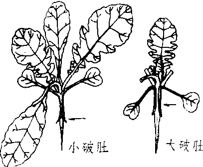
萝卜破肚
| 词条 | 破白 |
| 类别 | 中文百科知识 |
| 释义 | 破白见“破白合尖”。 破白cortical cleft of radish又称破肚。萝卜肉质根初生皮层破裂的现象。一般在播种后15~20天发生,它标志着萝卜幼苗期的结束和肉质根膨大期的开始。萝卜苗长到5~7片真叶时,主根形成层加速分裂生长,内部中柱组织因次生生长而迅速增粗,向外产生压力,而表皮及皮层却不再增大,造成表皮和皮层破裂、脱落现象。 此后植株生长加快。 要适时间苗、施肥、灌水,以满足肉质根迅速膨大生长的需要。
萝卜破肚 |
| 随便看 |
开放百科全书收录579518条英语、德语、日语等多语种百科知识,基本涵盖了大多数领域的百科知识,是一部内容自由、开放的电子版国际百科全书。