香芹菜parsley
伞形花科(Umbelliferae)欧芹属中一二年生草本植物。学名Petroselinum hor-tense Hoffm.,别名洋芫荽、旱芹菜、荷兰芹。染色体数2n=2x=22。香芹菜一般指叶用香芹,食嫩叶,作香辛蔬菜,宜生食、作汤或菜肴装饰品。与叶用香芹相近的还有根用香芹(P. hortense H. var.radi-cosum)。香芹菜原产地中海沿岸,西亚、古希腊及罗马早在公元前已开始利用,15~16世纪传到西欧。16世纪前专作药用,以后开始作蔬菜栽培。中国栽培较少。
果实小,圆形,褐色,有香气,根出叶浓绿,三回羽状复叶,叶缘锯齿状卷曲。4月至5月抽薹,高60厘米,先端开伞形小花,6月至7月份种子成熟。
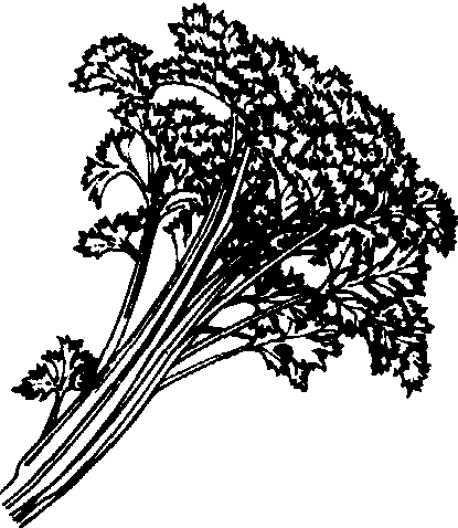
香芹菜
叶用香芹按叶面皱缩程度分为光叶与皱叶两类。
香芹菜适应性强,栽培容易,应选择冷凉阴湿地栽培。以果实作播种材料发芽很慢,夏播时应覆盖降温、保湿育苗;春播时用冷床或温床保温育苗。苗期30天,至2~3片真叶时移栽。条直播的须间苗除草。播种后3~4个月即可陆续采收外叶,直至翌年抽薹开花为止。
虫害有蚜虫,可用乐果防治;胡萝卜蝇(Psilarosae)用敌百虫浇根,厩肥应腐熟后使用。病害有叶斑病(Septoria apii),除加强通风透光外,可用波尔多液、代森锌等药剂防治。
香芹菜parsley
Petroselinum hortense Hoffm.,又称洋芫荽、旱芹菜、荷兰芹。伞形科,欧芹属。一二年生草本。2n=2x=22。原产地中海沿岸、西亚、古希腊及古罗马。15~16世纪传到西欧。16世纪前专作药用,后作蔬菜。中国栽培较少。适应性强,栽培容易,宜冷凉阴湿地栽培。果实小,圆形,褐色,有香气。根出叶浓绿,三回羽状复叶,叶缘锯齿状卷曲。4~5月抽薹,高60 cm,6~7月种子成熟。香芹菜可分为光叶和皱叶两类。一般食嫩叶,作香辛蔬菜,宜生食、作汤或菜肴装饰品。
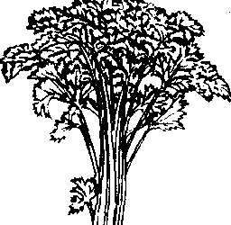
香芹菜
- (二)1956—1966年全面建设社会主义时期,农村党支部建设不断加强
- (二)1957—1959年的整党
- (二) 1957—1965年全面建设社会主义时期
- (二) 1958—1965年
- (二)1958—1978年农民人均纯收入增加慢,起伏大
- (二)1958年将乡镇改建人民公社
- (二)1960年前后两三年农民收入
- (二) 1966—1978年
- (二)1966—1978年
- (二)1978年后
- (二)1979—1992年的消费结构
- (二) 1979—1992年的甘肃农业
- (二) 1979—1995年
- (二) 1979—1995年的消费结构
- (二) 1979—1997年,公路建设快速发展
- (二) 1980—1984年农村信贷资金营运情况
- (二)1981—1992年的消费结构
- (二) 1987年后的农民体育
- (二)1990年林地所有制状况
- (二) 2020年前景展望
- (二)231工程
- (二) 50年代治淮全面展开
- (二)5月低温
- (二)60年代
- (二)60年代农村能源开发利用