甩腰Shuaiyao
腰功之一。是两腿分开站立,以腰、髋关节为轴上体前后甩动的动作。其主要作用是提高腰、髋前后运动的幅度和弹性。
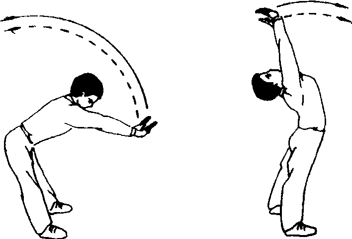
教学重点 强调挺膝和腰、髋要放松。
- (一)剿匪
- (一)加大农业投入,改善农业生产条件
- (一)加工企业带动型
- (一)加工能力
- (一)加强党员教育,提高党员素质
- (一) 加强农业基础
- (一)加强农业基础建设,提高水利化程度
- (一)加强农业基础设施建设,夯实农业基础
- (一)加强农业基础设施建设,改善农业生产条件
- (一)加强农业基础设施建设,确保粮食稳定增长
- (一) 加强农业建设,奠定综合经营基础
- (一)加强农业的基础地位不动摇
- (一) 加强农村卫生工作的领导
- (一)加强农田水利建设,改善农业生产条件
- (一)加强县
- (一)加强县、乡、村三级妇幼保健网络的建设
- (一)加强县农业技术推广中心的建设
- (一)加强基础设施建设
- (一)加强基础设施,改善农业生产条件
- (一)加强对农业和农村工作的领导
- (一) 加强对农民体育工作领导
- (一)加强对实施燎原计划工作的领导
- (一)加强扶贫领导
- (一)加强水利建设
- (一)加强水资源管理的重要性和紧迫性